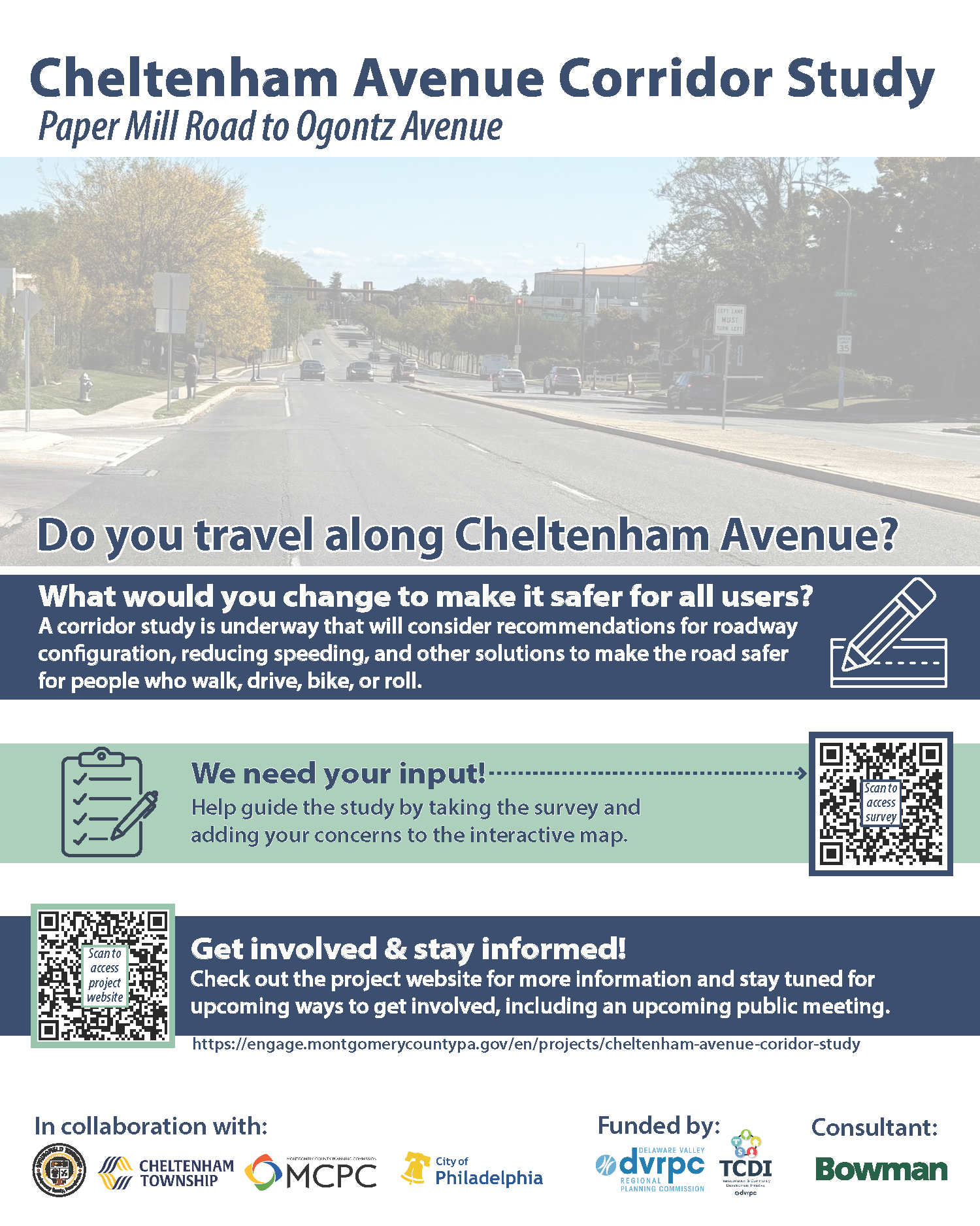
Springfield Township has partnered with Cheltenham Township, the City of Philadelphia, and Montgomery County to conduct a comprehensive transportation study of the Cheltenham Avenue corridor. The study aims to identify improvements that enhance safety and accessibility for motorists, pedestrians, cyclists, transit riders, and all roadway users.
With financial assistance from the Delaware Valley Regional Planning Commission (DVRPC), the multi-municipal team will evaluate Cheltenham Avenue (State Road 2035) from Paper Mill Road to Ogontz Avenue. This important regional roadway serves southern Montgomery County and the City of Philadelphia, with portions forming the boundary between Philadelphia and Cheltenham Township. At the western end of the corridor, Cheltenham Avenue lies entirely within Springfield Township.
Initial concerns identified along the corridor include gaps or lack of pedestrian and bicycle facilities, as well as areas experiencing high crash rates and excessive vehicle speeds. Many of these issues were also highlighted during the development of the Springfield Township Trail and Connectivity Plan, adopted in 2023.
The study will assess current and future conditions and develop potential roadway configurations that improve safety and better serve all users. Sixteen key intersections across Springfield Township, Cheltenham Township, and the City of Philadelphia will receive focused analysis. The final report, including findings and a preferred improvement option, is expected to be completed in June 2026.
We need your input!
Residents and roadway users are encouraged to participate in two ways:
- Share location-specific concerns by clicking on the interactive map and selecting “Submit a comment.”
- Complete the public survey to provide feedback, impressions, and ideas about the corridor.
Community input will play a vital role in shaping the future of Cheltenham Avenue.
For more information please visit the project website:
Cheltenham Avenue Corridor Project